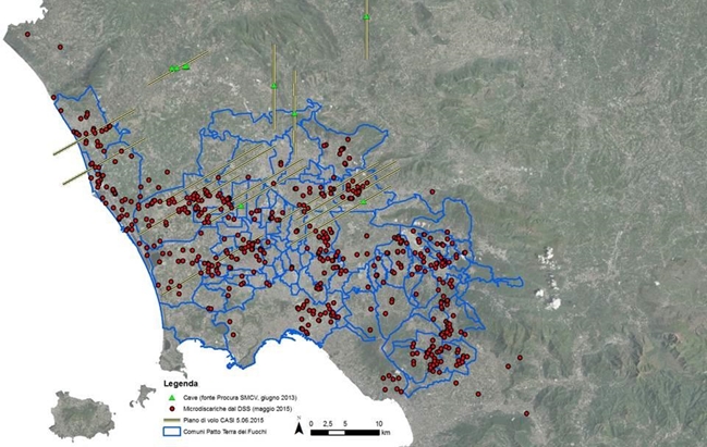
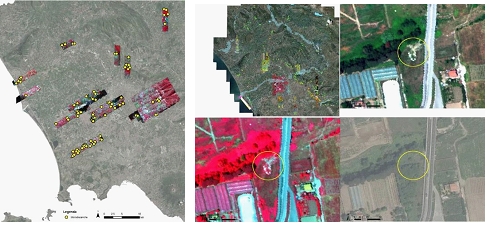
Land of Fires and Environmental Risk
Aerial remote sensing with hyperspectral, thermal and photographic sensors, cartographic restitution on GIS support, mapping and geo-database of micro-landfills and environment risks in the “Terra dei Fuochi/Land of Fires” and Environmental Risk, Campania Region. In cooperation with Italian Police, Guardia di Finanza. The investigation involves a multitemporal comparison between the acquired images and the historical cartography and the execution of a flight with a thermographic sensor to verify the presence or absence of thermal anomalies (Letters of commitment from Guardia di Finanza, Prot. 0111856/09-07.12.2009; Prot. 0030340/2017 – 09.03.2017; Prot. 0004294/2017 – 12.01.2017).